Hampton, New Hampshire collected more than $1.4 million in new federal flood-control commitments between July and September 2026, drawing from three separate programs with different purposes, different agencies, and different congressional authorizations. For a city of roughly 15,000 people on an 18-mile tidal coastline, that convergence is not coincidence. It is the product of a decade of deliberate positioning as one of the most-studied flood-exposed communities in New England.
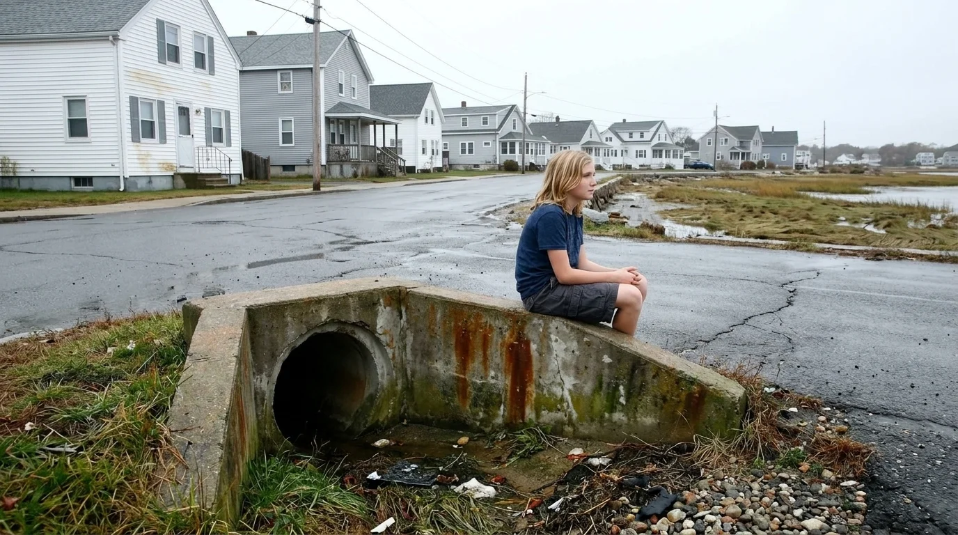
The largest single award, a $1.2 million FEMA Pre-Disaster Mitigation grant announced on September 18, 2026, will fund Hampton's Coastal Resiliency Storm Water Inflow/Infiltration Reduction Project: physical upgrades to a stormwater system that, during coastal storms, allows saltwater to back up into residential streets and basements. That grant flows through the FY2026 Homeland Security and Further Additional Continuing Appropriations Act under President Trump's America First Resilience Strategy. A separate $200,000 FEMA Hazard Mitigation award, approved in July, is paying for permanent repairs to a Hampton seawall damaged during January 2024 storms. The two grants come from different FEMA programs, triggered by different mechanisms, and are paying for different things.
The third strand is harder to see in the budget figures, but may be the most consequential for Hampton's long-term trajectory. The University System of New Hampshire, acting through NH Sea Grant and UNH Cooperative Extension, is currently soliciting a consultant to run what it is calling the Climate Courage Collective: a trauma-responsive community-engagement program for flood-vulnerable Hampton residents. The solicitation is the institutional successor to the Flood Ready Neighborhoods project, which used FEMA flood-hazard maps, CDC Social Vulnerability Index data, and sea-level-rise modeling to identify the most exposed households in Hampton, Portsmouth, Seabrook, and Exeter, then organized residents around that risk. The NOAA Adaptation Sciences grant that launched that pilot expired in August 2025.
Source: NationGraph.
The program did not expire with it.
That is the core of what is happening in Hampton. A federally seeded pilot, designed as an experiment, has become too embedded in the research and funding infrastructure of NOAA, FEMA, and UNH to be wound down when a single grant period ends. USNH is now institutionalizing the community-engagement model under a new name and a new funding vehicle, while simultaneously the physical infrastructure investments those community conversations helped justify are arriving from a different federal agency entirely. The seed money is gone; the pipeline it opened is not.
NHPR reported in August 2026 on the Gentian Road drainage project, a $4.3 million multi-source infrastructure upgrade in one of Hampton's most flood-prone neighborhoods. Residents described a roughly 75 percent reduction in flood incidents since its completion, a figure that matters less as a precise measurement than as a political one: it gives Hampton town officials and state figures like Executive Councilor Janet Stevens a concrete proof point when making the case for the next grant. Successful pilots become reference projects; reference projects attract new funding.
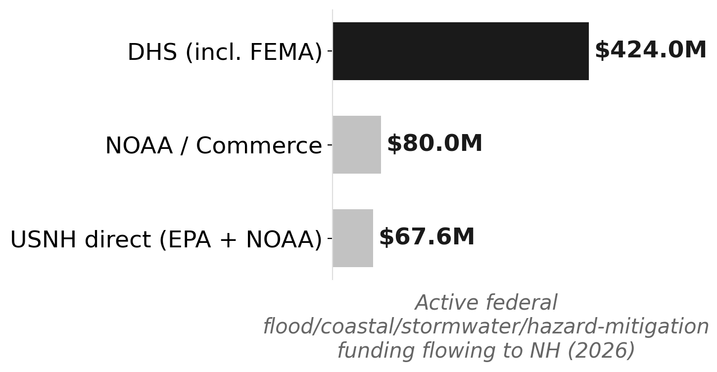
New Hampshire's broader federal flood-control portfolio illustrates what that accumulation looks like at scale. The state's active grant portfolio tagged to flood control, coastal resilience, stormwater, and hazard mitigation totals approximately $531 million, led by Department of Homeland Security awards of roughly $424 million and NOAA and Commerce Department grants of approximately $80 million. USNH alone holds an EPA Stormwater Center of Excellence designation worth $1.5 million through 2027, an NH Sea Grant omnibus of $3.1 million through 2028, and two NOAA coastal ocean-mapping grants totaling $63 million. The university system functions as the connective tissue between federal program officers and the municipalities they are trying to reach.
Hampton's geography makes it an unusually clean testbed. Its 18-mile tidal coastline packs flood-exposed households into a compact area where interventions are visible, measurable, and attributable. The Hampton-Seabrook Estuary, Meadow Pond, the town's aging stormwater outfalls, and a dense year-round residential population all sit within a short radius. For researchers at NH Sea Grant and for FEMA program officers evaluating where pre-disaster mitigation dollars will produce the clearest results, that density is an asset.
For Hampton residents living in the affected neighborhoods, the more immediate question is what the Climate Courage Collective actually delivers once the consultant is hired. The Flood Ready Neighborhoods model combined mapping with direct outreach; the successor program's trauma-responsive framing suggests the community-engagement component is being deepened, not reduced, even as its federal home shifts from a NOAA research grant to the Extension system.
The next visible signal will be whether USNH awards the Climate Courage Collective contract and which neighborhoods it prioritizes in its first program year. The stormwater infrastructure grant has a longer build timeline. Hampton's experience with Gentian Road suggests the gap between a federal award and a measurable neighborhood outcome can run several years. The funding is arriving faster than the pipes.