Harkers Island, North Carolina has spent years watching its marsh edges retreat into the Straits, the shallow sound that separates the island from the Down East mainland. Now Carteret County is moving to stabilize that shoreline the way coastal scientists have been recommending for a decade: with oyster reefs, marsh grass, and wave-absorbing sills rather than concrete and steel.
The county is seeking contractors for the Straits Living Shoreline and Upland Improvements project, listed on the county's bid portal, which would restore natural buffers along the waterfront while also improving upland areas that serve the public. The dual scope reflects a shift in how governments approach shoreline work: stabilizing the water's edge and the land behind it together, rather than treating them as separate problems.
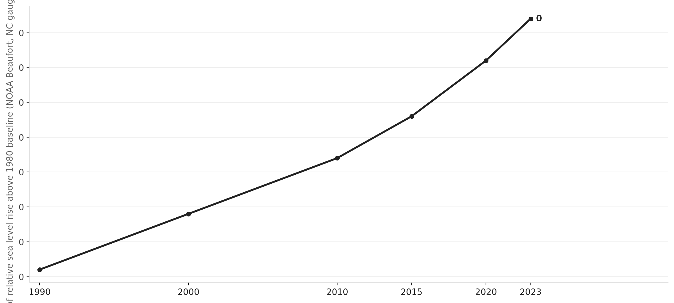
The timing is pointed. Hurricane Dorian's 2019 storm surge flooded most of Harkers Island, destroyed the Cape Lookout National Seashore visitor center, which was rebuilt and reopened only recently, and left a community that already lived close to the water feeling the ground shifting beneath it. Researchers at the NOAA Beaufort Laboratory and UNC Institute of Marine Sciences have been documenting marsh loss in the Straits for years.
Source: NationGraph.
The project is the local expression of a broader policy turn. North Carolina's Coastal Resources Commission created a streamlined permitting pathway for living shorelines in 2017, and NOAA formally designated them as the preferred coastal stabilization method in 2020, after research showed that traditional hardened structures like bulkheads accelerate erosion on neighboring properties while eliminating the intertidal habitat that fish, birds, and shellfish depend on. Federal money from the Bipartisan Infrastructure Law and the Inflation Reduction Act has since pushed tens of millions of dollars toward nature-based coastal projects across the state.
Harkers Island, a low-lying, unincorporated community of roughly 1,200 people, is among the most flood-exposed places in North Carolina. Its economy ties directly to what the shoreline provides: commercial fishing, boatbuilding, and the tourism that flows through the gateway to Cape Lookout National Seashore. Losing that shoreline, foot by foot, is a concrete economic threat, not an abstraction.
The full project budget and funding source were not included in the publicly posted bid documents. Bids were advertised Jan. 15, 2026, per the preliminary project schedule. Construction timelines will depend on which contractor the county selects after bids are reviewed.